Publications
PIXAM Presents Two GNSS Research Contributions at ICL-GNSS 2026 in Rome
01 Nov 2026
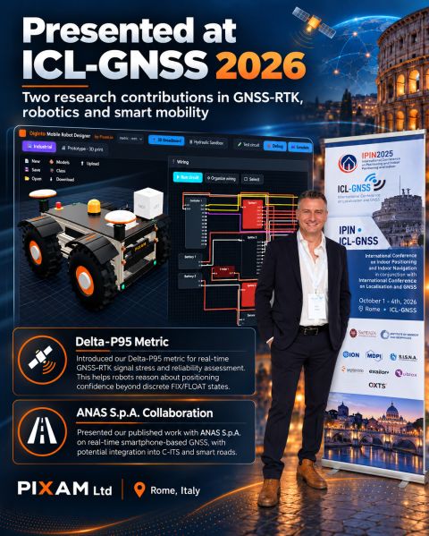 PIXAM LTD participated in the International Conference on Localization and GNSS (ICL-GNSS 2026), held in Rome, Italy, from 6–8 October 2026, presenting two research contributions focused on improving GNSS positioning reliability, real-time robotics and smart mobility applications.
The conference brought together researchers, academics and industry professionals working on satellite navigation, positioning technologies and intelligent systems.
Representing PIXAM, founder Steve Zerafa presented research highlighting the company's ongoing efforts to bridge academic research and practical technological development.
Delta-P95: Improving GNSS Positioning Reliability for Robotics
The first contribution introduced Delta-P95, a positioning reliability metric developed to assess the consistency of GNSS-RTK measurements in real time.
Although modern GNSS receivers can achieve centimetre-level accuracy using RTK corrections, positioning performance can deteriorate in challenging environments, particularly where buildings, trees and other obstacles interfere with satellite signals.
One of the key challenges is that a GNSS receiver may continue reporting an RTK FIX solution even when its calculated position has been affected by signal obstruction or multipath.
Delta-P95 addresses this challenge by providing an additional metric for assessing positioning reliability, helping robotic systems identify potential degradation in GNSS performance.
The research forms part of PIXAM's wider development of intelligent positioning technologies for autonomous ground robots and other applications requiring dependable navigation.
Collaboration with ANAS S.p.A.: GNSS and Smart Mobility
The second contribution presented research conducted in collaboration with ANAS S.p.A., the Italian national road infrastructure operator, investigating real-time smartphone-based GNSS positioning and its potential integration into Cooperative Intelligent Transport Systems (C-ITS).
The work explores how satellite positioning technologies can contribute to connected mobility, road infrastructure monitoring and intelligent transportation applications.
The research reflects the growing importance of accurate and reliable positioning in future smart mobility systems, where vehicles, infrastructure and digital platforms increasingly exchange location-related information.
Connecting Research with Real-World Applications
For PIXAM, participation in ICL-GNSS 2026 represents another step in its commitment to research-led innovation.
The company develops advanced GNSS positioning systems, robotic platforms and integrated hardware, firmware and software solutions serving applications ranging from telecommunications and infrastructure to agriculture and autonomous robotics.
Through its DigInto Tech platform, PIXAM also promotes practical engineering and robotics education, including online tools and learning resources for designing and building robotic systems.
Both research contributions demonstrate PIXAM's commitment to translating scientific research into practical technologies that improve positioning reliability, support autonomous systems and contribute to the development of smarter infrastructure.
The conference also provided an opportunity to exchange ideas with international researchers and explore future collaborations in GNSS, robotics and intelligent mobility.